Thursday, September 29, 2005

Tackling the Tatoosh Traverse


I just knew that last weekend, Sept 24-25, 2005, was going to be a blue-sky weekend. So I made last minute plans to get my 20 mile training run in on Saturday morning, pack up some gear and take off for Rainier N.P. on Saturday evening.

Because the weather was going to be so nice I decided to try to do the Tatoosh Traverse for the first time. Since I was going to be alone and the traverse is basically a one-way trip along the majority of the Tatoosh mountains I decided to stash my bike at the exit trailhead for Pinnacle Peak. I would then need to ride back down the road from Reflection Lake to Longmire. I was looking forward to this ride as it would be fast and almost all downhill!

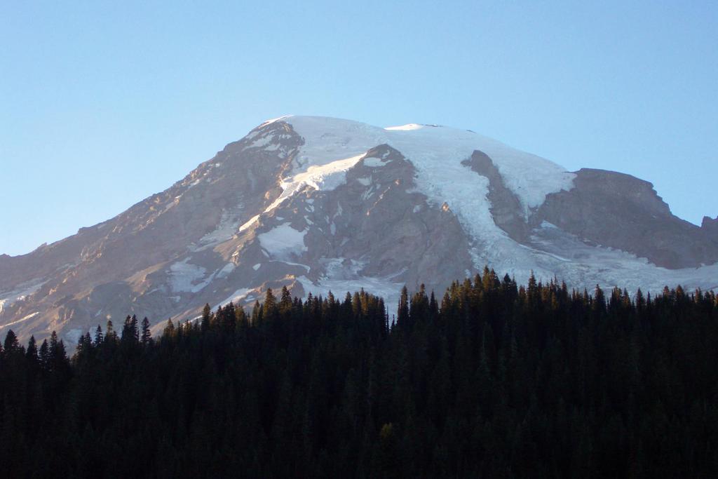
I snuck into the park late on Saturday and caught some zzz's in the back of the car. At around 7 A.M. I hid my bike up in the trees near the trailhead and zoomed down to Longmire for the start at the Eagle Peak trailhead. While hiding my bike near Reflection Lake I was not surprised to see that several people were arriving and setting up to take pictures of the sunrise and Mt. Rainier. Although it makes great sense to try and get good photos at sunrise it just seems so weird to me that people would drive all the way up (probably from their campgrounds or from home!) just to get some early morning photos. I figure if you are going to get up early to see the beauty of the morning, why not start a hike, get away from the pavement by at least a few miles and actually try to see something few others get to see. Anyone, and sometimes it seems like almost everyone, captures that postcard view from Reflection Lake. Sometimes it seems like photos, no matter how well done, mean nothing without a real experience to act as a caption. A little pain and suffering or epic adventure doesn't hurt to embibe that photo with some spirit. But I am getting off-topic. Being the hypocritical elitist that I am, I quickly took a couple of horribly exposed photos of the Mountain prior to starting my adventure.

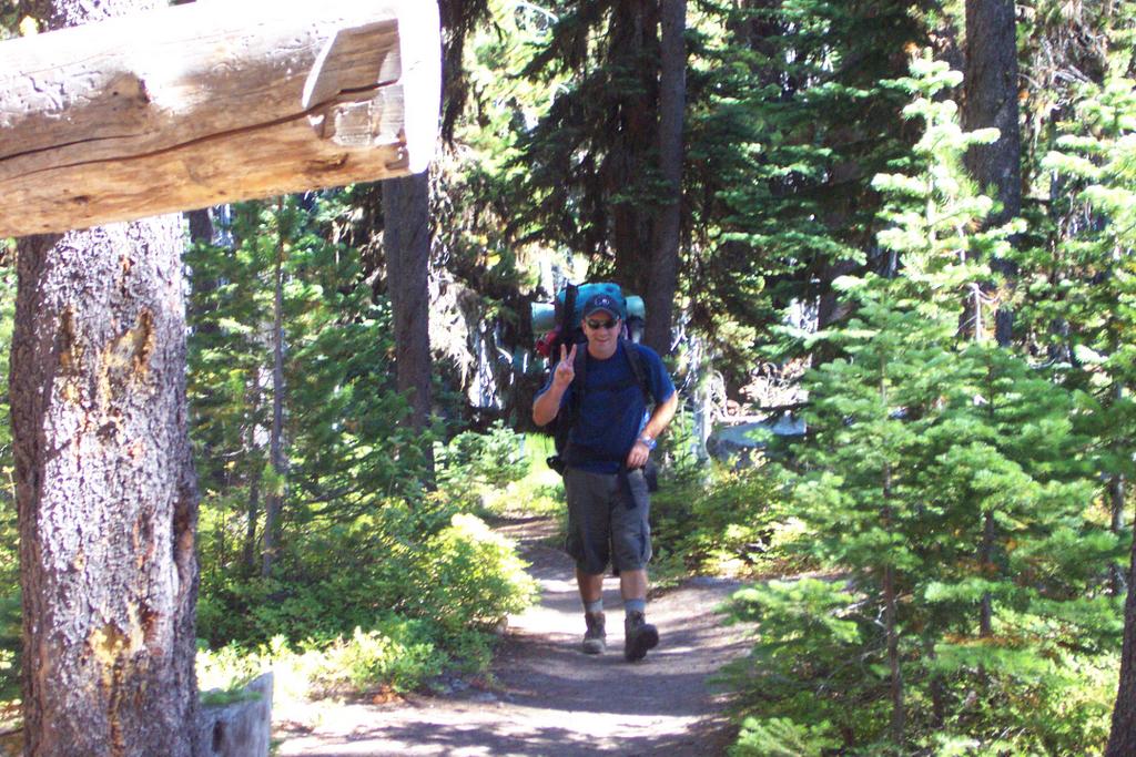
It seems like it took forever to get started on Sunday morning. At first I had a hard time trying to find the actual trailhead for Eagle Peak. And then I spent a good twenty minutes trying to figure out how I was going to carry water, food and minimal gear. Somehow I had forgotten my backpack at home but managed to bring all kinds of other gear, including the bladder for my Camelback and alot of food. In the end I made do with a small MSR bag and a webbing strap which I could drape over my shoulder. My jacket and fleece had to be worn or tied at the waist.

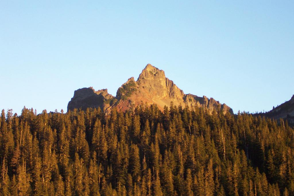
Around 8:30 AM I finally took off up the trail in a hurry. The section of the traverse I was doing was supposed to be only 10 miles in length with 7000 feet of elevation gain, but around 6 miles of this was off-trail bushwacking and scrambling. I was planning on scrambling up 7 peaks: Eagle, Chutla, Wahpenayo, Lane, Denman, Plummer and Pinnacle.

I made it to a saddle between Eagle and Chutla just before 10 AM. At 10:15 I had already climbed Eagle and made it back to the saddle! I was a little surprised that Eagle was so short and relatively easy, with maybe some 3rd to 4th class scrambling. I was surprised to see two guys top out at the saddle just as I was getting ready to head up Chutla. They said they were doing the traverse too. At least one of them had done a portion of the traverse from the opposite direction. I wished them luck and told them I would probably see them later in the day. I never saw them, except for when I was descending Chutla and I spied them finally topping out on Eagle.


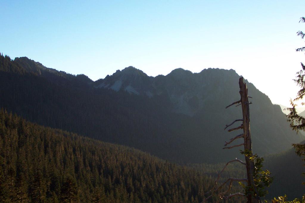
Chutla was even easier than Eagle with a decent scramble trail all the way to the top. I was feeling a little confident that I could complete the traverse. I knew from looking at a topo at home and talking to the other climbers that there might not be a doable traverse over Chutla. So I spent only a minimal amount of time looking for a way down the opposite side before giving up and heading back down to some meadows. From there I had to climb back up to a saddle between Chutla and Wahpenayo.

I spied a couple of goats as I ascended Wahpenayo. I was surprised that as soon as they saw me they clambered away in a hurry. I was at least a couple hundred yards from the goats. Unlike in the Enchantments and some other places I have been, the goats were actually scared of people. I took this to be a good sign that the park is still a little wild.

Made it to the top of Wahpenayo and wished I had time to sit down as there were quite a few nice warm boulders on which to take a lunch break. But I didn't spend more than three minutes on top before I was picking my way down to the west ridge. From this point until Lane peak I had to travel cross-country or on game trails as the route was not at all clear. I clambered down some rock fields and through some meadows until I was at a tarn below Lane Peak. I finally found a human trail, albeit a thin and overgrown one, at a small pass on the southwest side of Lane.

I started up Lane with some worries that I was running behind and that the peak was a little too dangerous for me. I made it about a third of the way to the top before I scared myself on the loose steep rock (some 4th class with loose rock) and turned around. I decided this would be a terrible place to have an accident since it appears that very few people visit this peak, in the middle of the traverse.

Soon after giving up on Lane I had scrambled up Denman and Plummer which were both easy hikes. Several people were at the top of Plummer which indicated I was back into the well-travelled backcountry. I dropped down to the Pinnacle and Plummer saddle and noticed a large group up on the rocks of Pinnacle. From where I was it looked like they were doing some serious climbing, with helmets and ropes. Since my guidebook (a piece of junk: 75 Scrambles in Washington) indicated the route headed northeast up the peak I traversed to the south side of the peak to look for an easy route. Of course this traverse was a waste of time just like so many other directions I have taken from this book. I ended up heading up to where I saw the climbers earlier.

The climbing got fairly serious with alot of exposure and relatively steep rock. I was a little surprised and definately a little scared. But since the rock was not loose, for the most part, and because a group was on the route I felt a little more secure. Soon I came upon their fixed rope hanging down the route. I stopped a couple of times to consider the danger but continued climbing next to the rope, knowing that I might be able to grab the rope as a handline if need be. I made it to the top and met a group of probably at least 10 students and a couple of instructors. I found out the group was from PLU and was part of a class. Since they were preparing to descend and I didn't want to fall behind the group I set about downclimbing in a hurry. I didn't really get to enjoy the view from here, but I know that this is a peak I should come back to for a relatively airy summit perch with an awesome view of Mt. Rainier.


The descent went quickly and I was back on the short Pinnacle peak trail before I knew it. Another mile down to my bike and I had completed 6 out of 7 summits of the Tatoosh. I definately felt that I had accomplished something. And I had done it on a gorgeous day in an absolutely beautiful setting! The icing on the cake was getting to zoom down the road on my bike. I am sure the park service frowns upon biking down the narrow road, but this was definately one of the highlights of the trip. I am already starting to wonder how to do the entire traverse which includes at least a couple more peaks on the south end of the Tatoosh range.

Wednesday, September 28, 2005

The Enchanted Cutthroat


On Labor day weekend 2005 my brother, Micah, and I explored the Enchantment Lakes area. Once again I was overwhelmed by the austere beauty and the 'enchanting' wildness of the Enchantment Lakes. But this time around Micah came (1st timer) and we had more time than I have had in the past to explore and do some fishing.

This was my fifth trip into the Enchantments so I was a little apprehensive that I would get bored with the scenery. I didn't get bored in the least, even though this trip was the longest at 4 days. In fact, I think I need to stay up there for awhile. Maybe a week or two will do me some good!

Anyway, we hiked in under partly cloudy and just slightly chilly conditions on a Friday afternoon. We started at the Snow Lakes Trailhead and hiked to our first campsite at the far end (western) end of Snow Lake. Although I usually don't stop at Snow Lakes we stopped since it was near dinner time and we wanted to try out the fishing on the lake. The lake was extremely low due to the drought conditions and the fact that the Forest Service was spilling water through the outlet pipe. The water level was at least 15 feet lower than normal!. So in order to go fishing we had to walk down the moderately steep sand beach and gingerly stand near the beach edge. The sand at the water line was like quicksand which threatened to take a shoe. In fact Micah's foot got sucked down at least once. At this lake we didn't catch any fish but we saw a few and at least one large fish was swimming around near the inlet stream.


On Saturday we climbed up to the Enchantment Lakes zone under sunny blue skies. We stopped at Lake Vivian (I think), at my favorite campsite near the waterfall and did a little fishing. The campsite was already occupied so we just had some lunch and caught a few cuththroat. We hiked on in search of a private camp and some secluded fishing. We came across quite a few people on the trail, including several fishermen, and at least I was getting nervous that we wouldn't be able to find an agreeable campsite. So we followed a trail which goes toward the Ingalls Creek Valley and ended up finding Crystal Lake. This was a great find as I had never been here before and it was so far off the path that we had the entire lake to ourselves. The lake sat in a deep valley somewhat protected by some cliffs on the lower portion of Little Anapurna and some cliffs which rose to McAllistar Peak (I think?). We set-up camp on a peninsula which juts out into the lake and went to work trying to catch some fish. We both caught quite a few little and medium sized cutthroat on just about any kind of dry fly we tied on. In fact I was getting a little tired of catching and releasing these small fish. The wind was picking up and it was getting cold as the sun went down behind Little Anapurna. Just before giving up for the day I walked back near the camp and found a large flat rock with a deep drop-off just off-shore. With my hands stinging from the cold I tied on a hopper and set it down less than 10 feet off-shore, right over the hole. In a flash the hopper was taken and I felt a good tug on the line. Although most of the fish put up a good fight as all good cutthroat do, I could tell that this fish was big by the strength of his tugs on the line. I pulled him in to find a beautiful 19-inch cutthroat who was a little past height-weight proportionate. He had some meat on him. I was so surprised and excited that I de-hooked him and ran across the peninsula to show Micah. It was pretty obvious we were gonna have to eat this beautiful enchanted fish. This was the first fish I have ever taken and eaten while still in the backcountry and definately one of the largest trout I have caught. When we cut him open and cleaned him we found to our surprise that his stomach was packed full of black ant bodies! This guy obviously had found a great spot to slurp down ants. Anyway we each got an 8-inch long (at least) fillet which we breaded and fried in some oil. With the fish we had our spicy Jamacian red beans and rice (dehydrated meals) and some bagels with cheese. Although the meal was by no means gourmet and it was not nearly as hard as some to cook in the backcountry, it was without a doubt one of the finest and most satisfying meals I have ever had while hiking.


After dinner we took a little walk at dusk and marvelled at the awesome landscape all around us. We shared a cigar and watched the stars come out. The clear night sky gave us an awesome view of the shiny part of the universe, but we paid for it as it was cold and very windy. Although we were probably less than a trail mile from our nearest neighbors it truly felt like we were in a wild and primeval place. An enchanted place.


The next day, Sunday, we hiked through the remainder of the Enchantment zone, where we saw even more people than the day before and a few mountain goats too. I stopped and caught another fish at another lake. Before long we were in the upper Enchantments where there are very few trees and little vegetation. We stashed our packs and made a quick dash to the top of Little Anapurna. The views and the vertigo were a little overwhelming on top as we could see many of the major peaks in Washington: Rainier, Adams, Glacier, Stuart, Baker, Daniel. We ended our day at the shores of Colchuk Lake after dropping down Asgard Pass. Just as we were setting up the tent it started to rain, but fortunately stopped soon thereafter. A little whisky and we crashed at our campsite nestled in the trees above the lake.


On our final day we did a little fishing at the lake but had no luck as the fish seemed to be far off-shore. Micah thought the fish were probably kokanee as they seemed to be travelling in schools. So we packed up around mid-day and had a relaxing hike out to the trailhead. Micah fanagled us a ride back to the Snow Lakes Trailhead where we quickly packed up and headed home.


All in all, I can't believe how hitch-free and relaxing this adventure was. It probably had a lot to do with the fact that I was in a truly wild and unique place with my best friend, my brother.

Tuesday, September 06, 2005

Mt. Rainier Climb


This post is a little late but I thought I should put down something about my recent climb of Mt. Rainier. The climb was significant mainly due to the fact that I have wanted to climb the mountain ever since my first unsuccesfull attempt over 10 years ago. It was also significant because Matt Heller and I were finally able to find a time when both of us could be at the mountain!

Our climbing trip started with a relaxing 3 mile walk to Glacier Basin camp on the northern side of the mountain on August 22, 2005. We camped in the trees at Glacier Basin and left for our high camp around 9 AM on the 23rd. We hiked up to the base of the Inter-Glacier where we put on crampons and started up the icy glacier. The inter-glacier presented few difficulties with only a few crevasses. It did however, present some risk of rockfall near the base. The inter-glacier was relatively uneventful except for the clouds/fog which periodically obscured the route. We de-cramponed at the top of the glacier and started hiking up the dirt/rock ridge passing Camp Curtis and getting some great views of the lower Emmons Glacier below us. At this point we had to decide whether or not to drop onto the Emmons and hike up to Camp Schurman or to climb over Steamboat Prow. We had received some warning that the drop onto the Emmons might just be a little too fast for us as it reportedly consists of ball-bearing size gravel on top of a hard and steep dirt slope. We decided not to chance the dirt downclimb. Instead we hiked to the top of Steamboat Prow and downclimbed a couple hundred feet of loose rock (4th class). At least for me, this truly was the hard part of the climb as there was significant exposure and I was downclimbing on really crumbly rock and gravel with a heavy pack (on the way out going up was much easier). After quite a bit of swearing on my part and some waiting on Matt's part we finally stepped into a windy and sometimes cloudy Camp Schurman.


At Camp Schurman we met a large guided group from Alpine Ascents who were also planning on a summit attempt on the morning of the 24th. We ate an early dinner around 4:30 PM and prepared for a start at 1:00 AM. Then we went to bed around 5:00 hoping to get some rest before the early start. I had a terrible time trying to get to sleep with the blinding light on the tent walls and the gusting winds. I really wished I could have slept in the ranger's hut which looked so cozy in contrast to our wind exposed perch between two glaciers. Just about the time I started to fall asleep, around 7 PM a noisy group stumbed into camp. They immediately set about making a racket until one of the neighboring guides asked them to keep it down. I awoke from my 2 to 3 hour nap around 12:15 AM when the guided group was preparing to leave. I got up and convinced Matt that we should leave early since there was no way I was going to get back to sleep until after the others left.

So we left camp at 12:45 AM and started hiking up the Emmons glacier under a clear but windy sky. Matt led us quickly through some of the lower crevasse fields and onto the "corridor" where we came upon the guided group (AA). We passed the AA group as they sent three climbers back down the hill. About this time the view was spectacular. Off to the northwest we could see some lights from the southern Seattle metro area and in the north we could see the aurora borealis. We trudged alongside the other group for awhile before temporarily losing them as we took a traversing route. As dawn started to lighten the mountain it became obvious that our traversing route was taking us into a labyrinth of crevasses. So we angled back a different direction and ended up far above the other group. After taking a short break probably somewhere around 13,000 feet we started a long traverse to make an end run around the bergschrund. We stepped across the bergschrund onto a saddle and realized we still had a long ways to go to get to Columbia Crest. We had both slowed by this point, but Matt was moving extremely slow now and it was 10 AM. To make a long story short we had an argument about whether or not to continue. I admit I said somethings which were mean and unfair. Since then I have apologized for my bad attitude.

Suffice it to say that Matt wanted to continue to the summit. So we took what we thought would be an easier route up a talus slope and finally made the summit at 11:11 AM. We spent just enought time for a few pictures on the frigid summit before starting our descent. It still amuses me that when we arrived at the summit Matt immediately sat down. All the pictures he took were from the sitting position. He didn't get up until we left! The view from the top was brilliant as we could see a relatively large area before the haze obscured the view. We could see Mt. Adams, St. Helens, Glacier, Stuart and I believe Baker.


The trip down was relatively uneventfull except for the fact that we were dog-tired and took far more time than the route required. We arrived back at Schurman sometime around 3:30 PM. We chose not to go home that day. Instead we passed out for about 12 hours before starting the walk home on August 25.


The climb was a great adventure and a significant learning experience for me. I was glad I had the chance to climb with Matt and hope that the bad feelings we both had as a result of our argument will stay on the mountain.

I can't wait to explore another place as awe-inspiring and beautiful as Mt. Rainier.